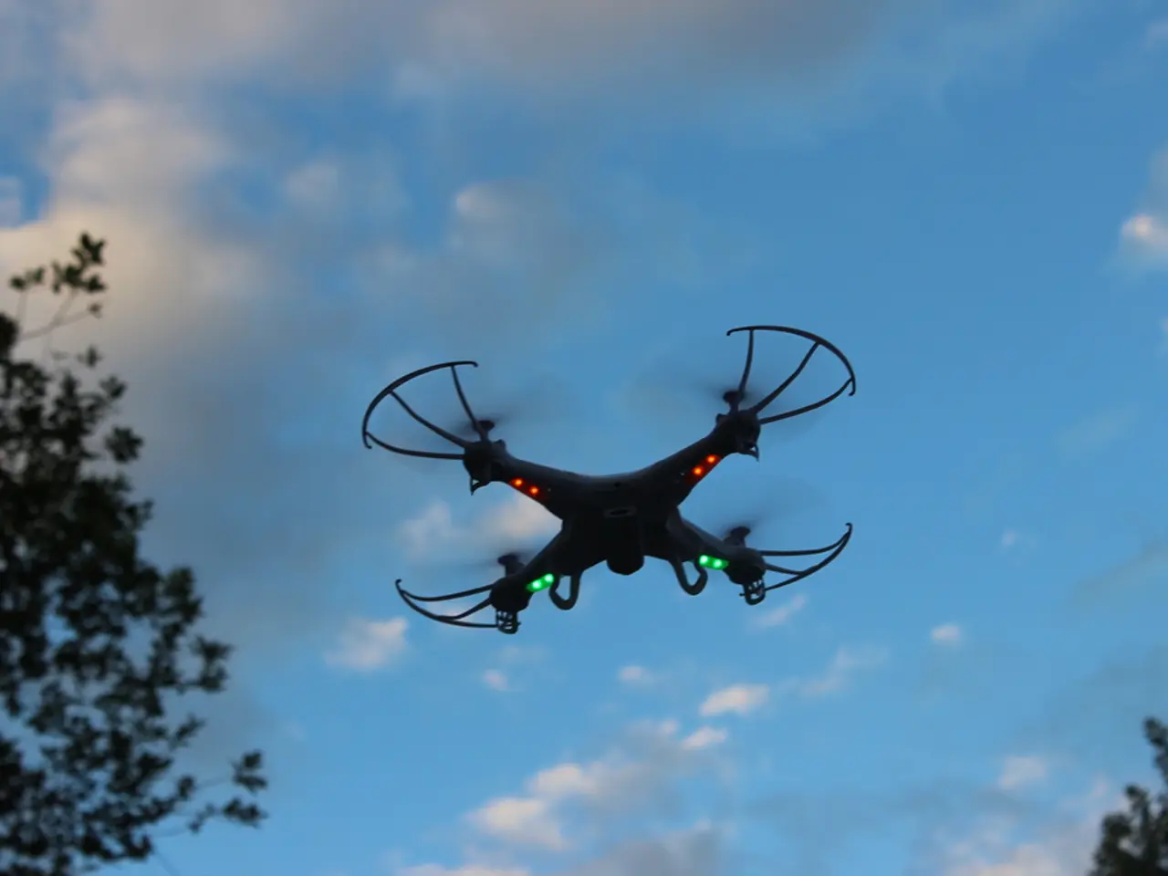
Exploring the Basics of Aerial Surveying with Drones
In the world of modern technology, drone mapping has emerged as a powerful tool for collecting and analysing spatial data. This innovative technique involves the use of processing software to combine images and data collected on the field, offering options for local or cloud-based processing [1].
At the heart of drone mapping is a process called photogrammetry, which generates 3D representations from overlapping photos [2]. This science of making measurements from photographs combines multiple images to reconstruct accurate 3D representations of terrain or objects. During drone flights, thousands of high-resolution images are taken, each with precise location data [1].
The process begins with data acquisition, where images are captured with sufficient overlap (each point visible in at least 3-4 photos) from varying angles while recording GPS data. This data is often enhanced by techniques like Ground Control Points (GCPs), Real-Time Kinematic (RTK) or Post-Processed Kinematic (PPK) GPS corrections to improve positional accuracy [1][2][3].
Once the data is collected, it is processed using photogrammetry software. Popular standalone programs for this purpose include Agisoft Metashape, which handles any type of spatial data and generates output such as orthomosaic maps, 3D models, point clouds, digital elevation models, and multispectral imagery [4].
The processed images are then analysed by identifying matching points across photos, reconstructing the scene into 3D models, orthomosaics (geographically corrected images), dense and sparse point clouds, and digital elevation models [2][4][5].
The resulting standard deliverables for a mapping job include orthomosaic, DSM (Digital Surface Model), point cloud, mesh, and 3D model [6]. These outputs can be used in Geographic Information System (GIS) platforms or CAD programs for further analysis and decision-making [1][2][5].
Photogrammetry in drone mapping enables efficient, safe, and cost-effective collection of detailed spatial data, transforming raw images into actionable 3D maps and models for applications in construction, mining, agriculture, environmental monitoring, and urban planning [2][5].
It is important to note that drone mapping operations are affected by daylight limitations, with optimal visibility being crucial but harsh lighting to be avoided [7]. A very bright and sunny day is not ideal for drone mapping, as harsh lighting can cause images to be over-exposed. Partly cloudy days disperse sunlight and make the scenery more evenly lit [7].
Pre-survey is also essential for scouting potential issues in the survey area, such as airspace restrictions, cell service availability, obstacles, signal interference, and terrain [8]. Rough terrain can be challenging to access, especially in remote areas where road access is not possible, requiring the setup of a base station for charging and supplies [9].
Data acquisition apps or software are used to plan a survey and execute them on the field, with DJI GS Pro, Pix4Dcapture, and Maps Made Easy being some of the most popular options [10]. Weather conditions, particularly extreme heat or cold, can affect drone flight performance and battery levels, requiring extra batteries when flying out in temperatures that are not optimal for drone flight [11].
Improvements in hardware and software have made drone mapping more accessible. Platforms like Pix4D and DroneDeploy provide end-to-end software solutions for mapping, offering a seamless workflow and not having to worry about file structure, organization, and compatibility [12].
In conclusion, drone mapping is a transformative technology that offers a wide range of opportunities for professionals and businesses. With its ability to generate detailed spatial data, drone mapping is poised to revolutionise industries such as construction, mining, agriculture, environmental monitoring, and urban planning.
References:
[1] Agisoft. (2021). Agisoft Metashape User Manual. Retrieved from https://docs.agisoft.com/Metashape_User_Manual/Content/User_Manual/Introduction.htm
[2] DroneDeploy. (2021). Drone Mapping 101. Retrieved from https://dronedeploy.com/learn/drone-mapping-101/
[3] Pix4D. (2021). Pix4D Accuracy. Retrieved from https://www.pix4d.com/accuracy
[4] UAV Coach. (2021). Photogrammetry Explained: The Basics of Creating 3D Models from Aerial Photos. Retrieved from https://uavcoach.com/photogrammetry-explained-basics-creating-3d-models-aerial-photos/
[5] Watts, J. (2018). Drone Mapping for Professionals. Retrieved from https://www.amazon.com/Drone-Mapping-Professionals-Mapping-GIS/dp/1787126336
[6] Zammit, J. (2019). Deliverables for Drone Mapping: What to Expect. Retrieved from https://www.uavcoach.com/deliverables-drone-mapping-expect/
[7] Drone U. (2021). The Best Time of Day for Drone Mapping. Retrieved from https://www.droneu.co/best-time-of-day-for-drone-mapping/
[8] Drone Pilot Ground School. (2021). Pre-Survey Checklist: How to Prepare for a Drone Survey. Retrieved from https://www.dronepilotgroundschool.com/blog/pre-survey-checklist-how-to-prepare-for-a-drone-survey/
[9] Drones Direct. (2021). Drone Mapping: What You Need to Know. Retrieved from https://www.dronesdirect.co.uk/blog/drone-mapping-what-you-need-to-know/
[10] DJI. (2021). DJI GS Pro. Retrieved from https://www.dji.com/gs-pro
[11] Drones Made Easy. (2021). Temperature Effects on Drones. Retrieved from https://www.dronesmadeeasy.com/blog/temperature-effects-on-drones/
[11] Skyward. (2021). Weather Considerations for Drone Operations. Retrieved from https://www.skyward.io/resources/blog/weather-considerations-for-drone-operations/
[12] DroneDeploy. (2021). End-to-End Drone Mapping Software. Retrieved from https://www.dronedeploy.com/
[13] FAA. (2021). Part 107: Small UAS Rule. Retrieved from https://www.faa.gov/uas/regulations_policies/part_107_small_uas_rule/
[14] DJI. (2021). DJI Air 2S. Retrieved from https://www.dji.com/air2s
[15] DJI. (2021). Phantom 4 Pro V2. Retrieved from https://www.dji.com/phantom-4-pro-v2
[16] UAV Coach. (2021). Rain and Drones: What You Need to Know. Retrieved from https://uavcoach.com/rain-drones-what-you-need-to-know/
[17] Ground Control Points. (2021). What are Ground Control Points? Retrieved from https://www.groundcontrolpoints.co.uk/
[18] National Geographic Society. (2021). Coordinate Systems. Retrieved from https://www.nationalgeographic.org/encyclopedia/coordinate-system/
[19] DroneLab. (2021). How to Start a Career in Drone Mapping. Retrieved from https://www.dronelab.co/blog/how-to-start-a-career-in-drone-mapping/
[20] European Global Navigation Satellite Systems Agency. (2021). Galileo. Retrieved from https://www.gsa.europa.eu/navigation/galileo
[21] National Oceanic and Atmospheric Administration. (2021). GPS. Retrieved from https://www.noaa.gov/what-is-gps
[22] National Geographic Society. (2021). WGS84. Retrieved from https://www.nationalgeographic.org/encyclopedia/wgs-84/
[23] United States Geological Survey. (2021). National Spatial Reference System. Retrieved from https://www.usgs.gov/faqs/what-is-national-spatial-reference-system?qt-news_science_products=0#qt-news_science_products
[24] National Geographic Society. (2021). State Plane Coordinate System. Retrieved from https://www.nationalgeographic.org/encyclopedia/state-plane-coordinate-system/
[25] National Oceanic and Atmospheric Administration. (2021). GLONASS. Retrieved from https://www.noaa.gov/what-is-glonass
[26] European GNSS Agency. (2021). Galileo and EGNOS. Retrieved from https://www.gsa.europa.eu/navigation/galileo-and-egnos
[27] European GNSS Agency. (2021). Beidou. Retrieved from https://www.gsa.europa.eu/navigation/beidou
[28] National Geographic Society. (2021). NAD83. Retrieved from https://www.nationalgeographic.org/encyclopedia/north-american-datum-1983/
[29] National Geographic Society. (2021). WGS84. Retrieved from https://www.nationalgeographic.org/encyclopedia/world-geodetic-system-1984/
[30] National Geographic Society. (2021). NTRIP. Retrieved from https://www.nationalgeographic.org/encyclopedia/networked-transport-of-rtcm-via-internet-protocol/
[31] National Geographic Society. (2021). RTK. Retrieved from https://www.nationalgeographic.org/encyclopedia/real-time-kinematic/
[32] National Geographic Society. (2021). PPK. Retrieved from https://www.nationalgeographic.org/encyclopedia/post-processed-kinematic/
[33] National Geographic Society. (2021). GPS Antenna. Retrieved from https://www.nationalgeographic.org/encyclopedia/gps-antenna/
[34] National Geographic Society. (2021). GPS. Retrieved from https://www.nationalgeographic.org/encyclopedia/global-positioning-system/
[35] National Geographic Society. (2021). Maps. Retrieved from https://www.nationalgeographic.org/encyclopedia/map/
[36] National Geographic Society. (2021). GIS. Retrieved from https://www.nationalgeographic.org/encyclopedia/geographic-information-system/
[37] National Geographic Society. (2021). GIS. Retrieved from https://www.nationalgeographic.org/encyclopedia/geographic-information-system/
The drone mapping process begins with data acquisition using precision GPS like RTK or PPK, capturing images with sufficient overlap while recording GPS data. This data is then processed using photogrammetry software such as Agisoft Metashape to generate 3D representations, orthomosaic maps, point clouds, and digital elevation models.
Following industry regulations like Part 107 of the FAA's rules for small unmanned aircraft systems, professionals should consider weather conditions, terrain, and potential issues in the survey area before executing a drone mapping project for applications in various industries such as construction, mining, agriculture, environmental monitoring, and urban planning.
