
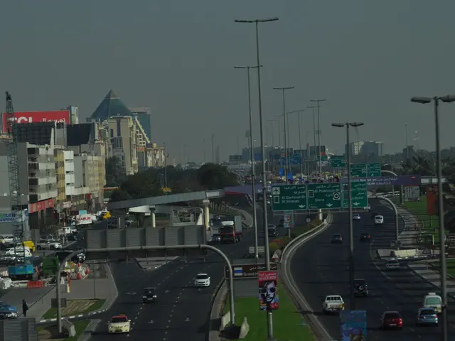
Three-dimensional, all-around image data captures Rhine-Kreis Neuss
Rhein-Kreis Neuss unveils its "Digital Twin" project, garnering significant interest from various circles. This initiative, spearheaded by IT director Harald Vieten, is a testament to the district's commitment to digitalization, according to a press release.
The "Digital Twin Rhein-Kreis Neuss" is a groundbreaking project that combines geodata from local administrations along the Rhine, Erft, and Gillbach rivers. This data offers high-resolution, three-dimensional 360-degree image data, similar to virtual reality, enabling users to visualize planning projects and simulation models in various sectors such as mobility, traffic, construction, climate, environment, and economy.
Michael Fielenbach, head of the Surveying and Cadastre Office Rhein-Kreis Neuss, explains, "This technology serves as a basis for smart city applications."
At the specialist conference "Forum Geodesy," the district's geodata expert, Christoph Kany, presented the project. The meeting attracted approximately 220 participants, including representatives from cities, districts, states, federal authorities, professional associations, and the Association of Districts. During the conference, the crucial role of geodata management in district administrations as essential hubs for municipalities was emphasized.
In the second phase of its construction, Rhein-Kreis Neuss is developing a cross-district uniform urban data platform as part of the "Digital Twin" project. This platform aims to facilitate the interaction and networking between municipal data sets, as well as state and federal data. In previous endeavors, specialists from the North Rhine-Westphalian districts had coordinated their content in the working group on geoinformation and surveying of the Association of Districts.
At its core, the urban data platform serves as a base and bundling function. It links all municipal specialist data in the Digital Twin with other data, making it available with municipal tools, analyses, and simulations for municipal planning tasks. The platform also supports collaboration with other data-leading bodies by employing standards and interfaces.
The potential benefits and applications of digital twin technology, such as efficiency, enhanced decision-making, and innovation, resonate with the "Digital Twin Rhein-Kreis Neuss" project. Possible applications for the district's initiative include optimizing infrastructure, enhancing sustainability, and improving public services. The specific objectives and details about the "Digital Twin Rhein-Kreis Neuss" project have yet to be disclosed.
- The "Digital Twin Rhein-Kreis Neuss" project, which is currently in its second phase of construction, integrates environmental data into its urban data platform, aiming to optimize infrastructure, enhance sustainability, and improve public services through data-and-cloud-computing technology.
- In the sphere of environmental applications, the "Digital Twin Rhein-Kreis Neuss" project's utilization of data-and-cloud-computing technology offers an opportunity for smart city developments, serving as a foundation for various sectoral planning projects and simulations, including climate and environment.